


Lac des Corbeaux et Séchemer

aubr
User

Length
6.7 km

Max alt
936 m

Uphill gradient
246 m
Km-Effort
10.1 km

Min alt
709 m

Downhill gradient
267 m
Boucle
Yes
Creation date :
2018-04-17 17:25:38.125
Updated on :
2018-04-17 17:25:38.125
2h17
Difficulty : Medium

FREE GPS app for hiking
 SityTrail
IGN / Geographical institutes
SityTrail Plus
The world is yours!
About
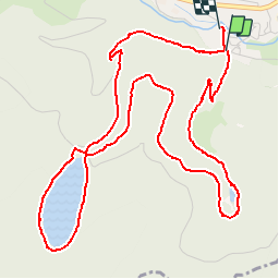
Trail Walking of 6.7 km to be discovered at Grand Est, Vosges, La Bresse. This trail is proposed by aubr.
Description
Boucle au départ du camping du Haut des Bluches
Tour du lac des Corbeaux et retour par l'étang de Sèchemer.
Possibilité de restauration à l'auberge du lac.

Positioning
Country:
France
Region :
Grand Est
Department/Province :
Vosges
Municipality :
La Bresse
Location:
Unknown
Start:(Dec)
Start:(UTM)
344629 ; 5318283 (32T) N.
Comments